Rivers, Railroads, Canals
|
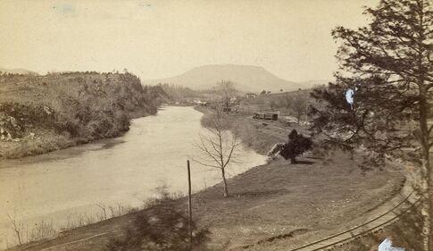
The Chessie Trail lies along the the old Chesapeake and Ohio Railroad right-of-way, which in turn follows the path of the Maury River between Lexington and Buena Vista, VA.
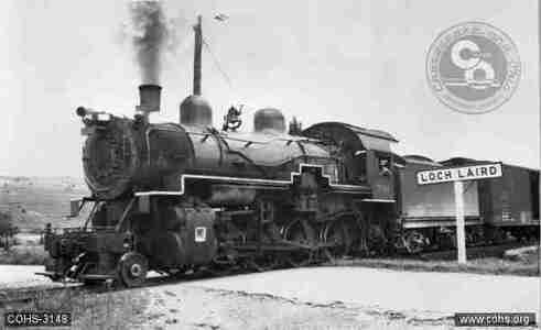
As Matt Paxton explains in The Field Guide to the Chessie Nature Trail, in 1881, “the first train from Richmond chugged over what is now the Chessie Trail,” bringing a rail link to the river towns of Buena Vista and Lexington via Balcony Falls, a stop whose BF mile markers can still be seen along the Trail today. But before there were railroads, there were canals, and before the canals, the long, slender river bateaux plied their way up what was then called the North River from the James River at Lynchburg. Rockbridge County sent its iron, wheat, and lumber south and east to Richmond and the world beyond via the bateaux and later the canal boats, and finished goods came back up the rivers. With the advent of the canal system, passengers also traveled up and down river in some comfort. The potential for a trail was brought to the attention of the Nature Conservancy by the Rockbridge Area Conservation Council in the late 1970s. The deed for the Trail passed from the Nature Conservancy to the VMI Foundation in 1979, and from the Foundation to the Institute itself in 2013. The remnants of that world of commerce and travel may be seen today along the Chessie Trail from Jordan's Point in Lexington to Zimmerman’s Lock in Buena Vista. |
|
Website created by Laurel Worth Sheffield. © Friends of the Chessie Trail
